Beaurières
Gemeente in Frankrijk  | |||
|---|---|---|---|
  | |||
| Situering | |||
| Regio | Auvergne-Rhône-Alpes | ||
| Departement | Drôme (26) | ||
| Arrondissement | Die | ||
| Kanton | Le Diois | ||
| Coördinaten | 44° 35′ NB, 5° 33′ OL | ||
| Algemeen | |||
| Oppervlakte | 24,58 km² | ||
| Inwoners (1 januari 2021) | 74[1] (3 inw./km²) | ||
| Hoogte | 641 - 1440 m | ||
| Burgemeester | Bernard Russier (2014-2020) | ||
| Overig | |||
| Postcode | 26310 | ||
| INSEE-code | 26040 | ||
| Foto's | |||
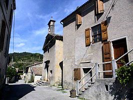 | |||
| Centrum met temple (Protestantse kerk) | |||
| |||

Beaurières is een gemeente in het Franse departement Drôme (regio Auvergne-Rhône-Alpes) en telt 84 inwoners (2009). De plaats maakt deel uit van het arrondissement Die.
Geografie
De oppervlakte van Beaurières bedraagt 24,3 km², de bevolkingsdichtheid is dus 3,5 inwoners per km².

Demografie
Onderstaande figuur toont het verloop van het inwonertal (bron: INSEE-tellingen).

Externe links
- (fr) Statistische informatie op de website van INSEE
Mediabestanden
Zie de categorie Beaurières van Wikimedia Commons voor mediabestanden over dit onderwerp.
- ↑ Populations légales 2021.


