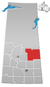
White Fox, Saskatchewan
White Fox (2021 population: 343) is a village in the Canadian province of Saskatchewan within the Rural Municipality of Torch River No. 488 and Census Division No. 14. It is on Highway 55 near the White Fox River and nearly 14 km northwest of the Town of Nipawin. White Fox has a community hall for use by local residents, a public library, post office, a skating and curling facility, and a campground/RV park.
History
White Fox incorporated as a village on July 21, 1941.[2]
Demographics
In the 2021 Census of Population conducted by Statistics Canada, White Fox had a population of 343 living in 154 of its 175 total private dwellings, a change of -3.4% from its 2016 population of 355. With a land area of 0.99 km2 (0.38 sq mi), it had a population density of 346.5/km2 (897.3/sq mi) in 2021.[5]
In the 2016 Census of Population, the Village of White Fox recorded a population of 355 living in 165 of its 184 total private dwellings, a -2.5% change from its 2011 population of 364. With a land area of 0.85 km2 (0.33 sq mi), it had a population density of 417.6/km2 (1,081.7/sq mi) in 2016.[6]
References
- ^ "White Fox Water System Upgrade Celebrated". Government of Saskatchewan. July 11, 2015. Retrieved May 11, 2016.
- ^ "Urban Municipality Incorporations". Saskatchewan Ministry of Government Relations. Archived from the original on October 15, 2014. Retrieved June 1, 2020.
- ^ "Saskatchewan Census Population" (PDF). Saskatchewan Bureau of Statistics. Archived from the original (PDF) on September 24, 2015. Retrieved May 31, 2020.
- ^ "Saskatchewan Census Population". Saskatchewan Bureau of Statistics. Retrieved May 31, 2020.
- ^ "Population and dwelling counts: Canada, provinces and territories, census divisions and census subdivisions (municipalities), Saskatchewan". Statistics Canada. February 9, 2022. Retrieved April 1, 2022.
- ^ "Population and dwelling counts, for Canada, provinces and territories, and census subdivisions (municipalities), 2016 and 2011 censuses – 100% data (Saskatchewan)". Statistics Canada. February 8, 2017. Retrieved May 30, 2020.
- v
- t
- e
- Abbey
- Abernethy
- Albertville
- Alida
- Alvena
- Annaheim
- Archerwill
- Arran
- Atwater
- Avonlea
- Aylesbury
- Aylsham
- Bangor
- Beatty
- Beechy
- Belle Plaine
- Bethune
- Bjorkdale
- Bladworth
- Borden
- Bracken
- Bradwell
- Briercrest
- Brock
- Broderick
- Brownlee
- Buchanan
- Buena Vista
- Bulyea
- Cadillac
- Calder
- Canwood
- Carievale
- Caronport
- Ceylon
- Chamberlain
- Chaplin
- Christopher Lake
- Clavet
- Climax
- Coderre
- Codette
- Coleville
- Conquest
- Consul
- Craven
- Creelman
- Dafoe
- Debden
- Denholm
- Denzil
- Dilke
- Dinsmore
- Disley
- Dodsland
- Dorintosh
- Drake
- Drinkwater
- Dubuc
- Duff
- Duval
- Dysart
- Earl Grey
- Ebenezer
- Edam
- Edenwold
- Elbow
- Elfros
- Endeavour
- Englefeld
- Ernfold
- Eyebrow
- Fairlight
- Fenwood
- Fillmore
- Findlater
- Flaxcombe
- Forget
- Fosston
- Fox Valley
- Frobisher
- Frontier
- Gainsborough
- Gerald
- Glaslyn
- Glen Ewen
- Glenavon
- Glenside
- Golden Prairie
- Goodeve
- Goodsoil
- Goodwater
- Grayson
- Halbrite
- Harris
- Hawarden
- Hazenmore
- Hazlet
- Heward
- Hodgeville
- Holdfast
- Hubbard
- Hyas
- Invermay
- Jansen
- Kelliher
- Kenaston
- Kendal
- Kennedy
- Kenosee Lake
- Killaly
- Kincaid
- Kinley
- Kisbey
- Krydor
- Laird
- Lake Lenore
- Lancer
- Landis
- Lang
- Leask
- Lebret
- Leoville
- Leross
- Liberty
- Limerick
- Lintlaw
- Lipton
- Loon Lake
- Loreburn
- Love
- Lucky Lake
- MacNutt
- Macoun
- Macrorie
- Major
- Makwa
- Mankota
- Manor
- Marcelin
- Marengo
- Margo
- Markinch
- Marquis
- Marsden
- Maryfield
- Maymont
- McLean
- McTaggart
- Meacham
- Meath Park
- Medstead
- Mendham
- Meota
- Mervin
- Middle Lake
- Milden
- Minton
- Mistatim
- Montmartre
- Mortlach
- Muenster
- Neilburg
- Netherhill
- Neudorf
- Neville
- North Portal
- Odessa
- Osage
- Paddockwood
- Pangman
- Paradise Hill
- Parkside
- Paynton
- Pelly
- Pennant
- Perdue
- Pierceland
- Pilger
- Pleasantdale
- Plenty
- Plunkett
- Prelate
- Prud'homme
- Punnichy
- Quill Lake
- Quinton
- Rama
- Rhein
- Richard
- Richmound
- Ridgedale
- Riverhurst
- Roche Percee
- Ruddell
- Rush Lake
- Sceptre
- Sedley
- Semans
- Senlac
- Shamrock
- Sheho
- Shell Lake
- Silton
- Simpson
- Smeaton
- Smiley
- Spalding
- Speers
- Spy Hill
- St. Benedict
- St. Gregor
- St. Louis
- Stenen
- Stewart Valley
- Stockholm
- Storthoaks
- Strongfield
- Success
- Tantallon
- Tessier
- Theodore
- Togo
- Tompkins
- Torquay
- Tramping Lake
- Tugaske
- Tuxford
- Val Marie
- Valparaiso
- Vanguard
- Vanscoy
- Vibank
- Viscount
- Waldeck
- Waldron
- Waseca
- Webb
- Weekes
- Weirdale
- Weldon
- White Fox
- Wilcox
- Windthorst
- Wiseton
- Wood Mountain
- Yarbo
- Young
- Zelma
- Zenon Park
- Culture
- Economy
- First Nations
- Geography
- Government
- History
- Regions
- Tourist attractions
 Category
 Canada portal
 WikiProject
 | This Saskatchewan location article is a stub. You can help Wikipedia by expanding it. |
- v
- t
- e


