South Branch Raritan River
River in New Jersey, United States
40°51′48″N 74°45′07″W / 40.86333°N 74.75194°W / 40.86333; -74.75194[1] • location
• coordinates
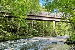
The South Branch Raritan River is a 50-mile-long (80 km)[2] tributary of the Raritan River in New Jersey.[3]
Description
The source of the South Branch is the outflow from Budd Lake, a glacial remnant located a few miles northeast of Hackettstown. The river flows out of Morris County, down the middle of Hunterdon County, and along the western edge of Somerset County.[3]
At its end, it forms the border between Branchburg and Hillsborough Townships and, upon reaching the border of Bridgewater Township, joins the North Branch Raritan River to form the Raritan River, which generally flows eastward from that point. This area where the branches converge was called "Tucca-Ramma-Hacking" by the Lenape meaning the flowing together of water. It was called "Two Bridges" by the early European settlers, after a set of bridges built in 1733 that met at a small island (the island has washed away over time) on the North Branch.[4] Today the area is generally referred to as "The Confluence". In the 1970s, the state discussed plans for a Raritan Confluence Reservoir, which have been shelved due to acquisition costs.
The river’s local grassroots organization is the South Branch Watershed Association. Their mission is to “Protect the Water Resources of the South Branch of the Raritan River and its Watershed”. Established in 1959, the South Branch Watershed Association is one of the oldest and largest watershed associations in New Jersey, covering 276 square miles, 3 counties and 25 municipalities. The group offers homeowner well testing, environmental education, river monitoring, annual river cleanup and stream restoration.
Both North and South branches of the Raritan run nearly parallel southwards, east and west of one another, but receive their names from the direction each one flows from at their confluence.
Gallery
-
 Confluence of the South Branch and the North Branch with the Raritan River

-
 Flowing past the Obadiah Latourette Grist and Saw Mill in Long Valley
 -
 Dunham's Mill, home to the Hunterdon Art Museum, and the Clinton Dam
 -


Tributaries
- Allerton Creek
- Assicong Creek
- Beaver Brook
- Bushkill Brook
- Capoolong Creek
- Cramers Creek
- Drakes Brook
- Electric Brook
- Holland Brook
- Little Brook
- Minneaconing Creek
- Neshanic River
- Pleasant Run (Campbell's Brook)
- Prescott Brook
- Spruce Run
- Mulhockaway Creek
- Sidney Brook
- Stony Brook (Washington Township - Morris County)
- Turkey Brook
See also
References
- ^ a b "South Branch Raritan River". Geographic Names Information System. United States Geological Survey, United States Department of the Interior.
- ^ "The National Map". U.S. Geological Survey. Retrieved Feb 10, 2011.
- ^ a b Gertler, Edward. Garden State Canoeing, Seneca Press, 2002. ISBN 0-9605908-8-9
- ^ New Jersey Historical Society. "Proceedings of the New Jersey Historical Society." Newark: New Jersey Historical Society, 1924.
External links
 Media related to South Branch Raritan River at Wikimedia Commons
- U.S. Geological Survey: NJ stream gaging stations
- South Branch Watershed Association
40°40′40″N 74°52′44″W / 40.677829°N 74.878812°W / 40.677829; -74.878812
- v
- t
- e
Raritan Valley
| Geography |
|  |
|---|
| Central communities |
|---|
| Larger-sized communities (over 25,000 in 2020) |
|---|
| Smaller-sized communities (10,000 to 25,000 in 2020) |
|---|
| Counties | |
|---|---|
| History |

| Authority control databases |
|
|---|


