Minami-ku, Okayama
Ward of Okayama in Chūgoku, Japan
Minami 南区 | |
|---|---|
Ward of Okayama | |
| 南区• Minami-ku | |
 Ward office of Minami-ku | |
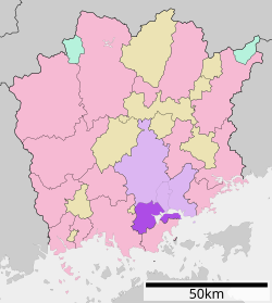 Location of Minami-ku in Okayama | |
| 34°32′38″N 133°51′55″E / 34.54389°N 133.86528°E / 34.54389; 133.86528 | |
| Country | Japan |
| Region | Chūgoku |
| Prefecture | Okayama |
| City | Okayama |
| Area | |
| • Total | 127.36 km2 (49.17 sq mi) |
| Population | |
| • Total | 165,193 |
| • Density | 1,297/km2 (3,360/sq mi) |
| Time zone | UTC+9 (Japan Standard Time) |
| Address | 207 Kataoka, Minami-ku, Okayama, Okayama Prefecture 709-1292 |
| Website | Official website of Minami-ku |
Minami-ku (南区) is one of four wards of Okayama, Okayama Prefecture, Japan. The ward has an area of 127.36 km2 and a population of 165,193. The population density is 1,297 per km2. The name means "South Ward."
The wards of Okayama were established when Okayama became a city designated by government ordinance on April 1, 2009.
References
External links
![]() Media related to Minami-ku, Okayama at Wikimedia Commons
Media related to Minami-ku, Okayama at Wikimedia Commons
- 岡山市南区役所 (Ward office official home page)


| Authority control databases: Geographic |
|
|---|
 | This Okayama Prefecture location article is a stub. You can help Wikipedia by expanding it. |
- v
- t
- e


