Kaʻala
Highest mountain on the island of Oahu, Hawaii, US

Kaʻala
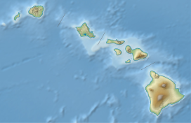
Hawaiian Islands
Kaʻala or Mount Kaʻala (pronounced [kəˈʔɐlə] in Hawaiian) is the highest mountain on the island of Oahu, at 1,227 metres (4,026 ft). It is a part of the Waianae Range, an eroded shield volcano on the west side of the island. The FAA maintains an active tracking station at the summit, which is closed to the general public and secured by the US Army which is stationed at the base of the mountain, at Schofield Barracks. The tracking station can be clearly seen from afar as a white, domed-shaped structure.
See also
- List of mountain peaks of the United States
- Evolution of Hawaiian volcanoes
- Hawaii hotspot
- Hawaiian–Emperor seamount chain
References
- ^ "Mt. Mount Ka'ala". Department of Forestry and Wildlife. State of Hawaii. Retrieved 2013-02-21.
- ^ "Ka'ala". Geographic Names Information System. United States Geological Survey, United States Department of the Interior. Retrieved 2009-12-23.
 Oceania portal
 United States portal
 Hawaii portal
 Mountains portal
 Volcanoes portal


- v
- t
- e
Hawaiian volcanism topics (list) | ||
|---|---|---|
| Windward Isles |
|  |
| Leeward Isles | ||
| Emperor Seamounts | ||
| Notable eruptions and vents | ||
| Topics |
| |


