Itapiranga, Amazonas
Municipality in North, Brazil

Seal
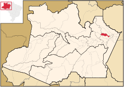
Location of the municipality inside Amazonas
 Brazil
 (2020)
Itapiranga is a municipality located in the state of Amazonas northern Brazil on the left bank of the Solimões River about 200 km east of Manaus. Its population was 9,230 (2020)[1] and its area is 4,231 km2.[2]
Name
The name is of Indian origin, and was given to a quarry which has a port. It comes from ita, stone and pitanga, red, so the name means "red stone".
Geography
The municipality contains about 40% of the 424,430 hectares (1,048,800 acres) Uatumã Sustainable Development Reserve, which protects the lower part of the Uatumã River basin.[3]
History
It was founded in 1931 as a suburb of Silves.
References
- v
- t
- e
Capital: Manaus
Centro Amazonense
| Coari | |
|---|---|
| Itacoatiara |
|
| Manaus | |
| Parintins | |
| Rio Preto da Eva | |
| Tefe |

Norte Amazonense
| Japura | |
|---|---|
| Rio Negro |
Sudoeste Amazonense
| Alto Solimoes | |
|---|---|
| Jurua |
Sul Amazonense
| Boca do Acre | |
|---|---|
| Madeira | |
| Purus |
 | This article about a location in the Brazilian state of Amazonas is a stub. You can help Wikipedia by expanding it. |
- v
- t
- e


