Hibran, Syria
Village in Suwayda, Syria
Hibran حبران Hebran, Hubran | |
|---|---|
Village | |
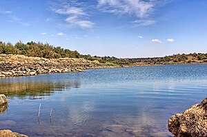 Hibran dam | |
| 32°36′20″N 36°38′21″E / 32.60556°N 36.63917°E / 32.60556; 36.63917 | |
| Grid position | 303/224 |
| Country |  Syria Syria |
| Governorate | Suwayda |
| District | Suwayda |
| Subdistrict | Suwayda |
| Population (2004 census)[1] | |
| • Total | 3,166 |
| Time zone | UTC+2 (EET) |
| • Summer (DST) | UTC+3 (EEST) |
Hibran, also spelled Hebran or Hubran (Arabic: حبران, romanized: Ḥibrān), is a village in southern Syria, administratively part of the Suwayda Governorate, located south of Suwayda. According to the Syria Central Bureau of Statistics (CBS), Hibran had a population of 3,166 in the 2004 census.[1]
History
Hibran was noted in the 1596 Ottoman census under the name of Hubran an-Nasara, being located in the nahiya of Bani Nasiyya in the Liwa of Hawran. It had a population of 23 households and 14 bachelors; all Muslim. They paid a fixed tax-rate of 40% on various agricultural products, including wheat (=1500 akçe), barley (900), summer crops (900), goats and beehives (100); a total of 3,400 akçe.[2]
Ottoman tax records indicate the revenues of Hibran were farmed out to Muhammad Alam al-Din, a Druze emir who fled Mount Lebanon in 1667, in 1669–1671.[3]
According to the historian Kais Firro, Hibran was one of twenty-eight villages in the Hauran settled by Druze before 1812;[4] in 1838 Hibran was noted as Druse village by Eli Smith.[5]
The Druze chieftain Ismail al-Atrash encouraged further Druze migration to Hibran, among a number of other Hauran villages, from Mount Lebanon in the 1850s.[6]
References
- ^ a b "General Census of Population and Housing 2004" (in Arabic). Syria Central Bureau of Statistics (CBS). 2013-01-12.
- ^ Hütteroth & Abdulfattah 1977, p. 220.
- ^ Hourani 2010, p. 951.
- ^ Firro 1992, p. 150.
- ^ Robinson & Smith 1841, p. 158.
- ^ Firro 1992, p. 189.
Bibliography
- Firro, Kais (1992). A History of the Druzes. Brill. ISBN 90-04-09437-7.
- Hourani, Alexander (2010). New Documents on the History of Mount Lebanon and Arabistan in the 10th and 11th Centuries H. Beirut.
{{cite book}}: CS1 maint: location missing publisher (link) - Hütteroth, Wolf-Dieter; Abdulfattah, Kamal (1977). Historical Geography of Palestine, Transjordan and Southern Syria in the Late 16th Century. Erlanger Geographische Arbeiten, Sonderband 5. Erlangen, Germany: Vorstand der Fränkischen Geographischen Gesellschaft. ISBN 3-920405-41-2.
- Robinson, E.; Smith, E. (1841). Biblical Researches in Palestine, Mount Sinai and Arabia Petraea: A Journal of Travels in the year 1838. Vol. 3. Boston: Crocker & Brewster.
- v
- t
- e
| |||||||||


| |||||||
| |||||||||||


