Chambeyron Massif
Mountain range in France and Italy


Chambeyron Massif

Chambeyron Massif
Chambeyron Massif

Chambeyron Massif
 France
 Italy
Italy


- Provence-Alpes-Côte d’Azur
- Piedmont
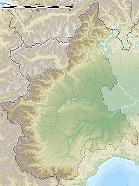
The Chambeyron massif (French: Massif de Chambeyron, Italian: Gruppo del Chambeyron) is a massif in the Alps, straddling between France and Italy, between the Escreins Massif, the Cottian Alps and the Mercantour-Argentera massif. It occupies the high valleys of Ubaye, Maira, Varaita and Stura di Demonte.[1]
Main summits
The main peaks are:
- Aiguille de Chambeyron, 3,412 m
- Brec de Chambeyron, 3,389 m
- Bric de Rubren, 3,340 m
- Pointe d’Aval (or Chauvet), 3,320 m
- Pic du Pelvat, 3,220 m
- Tête de Malacoste, 3,216 m
- Brec de l’Homme, 3,211 m
- Pointe-Haute de Mary, 3,206 m
- Roche Blanche, 3,193 m
- Pointe du Fond du Roure, 3,184 m
- Dents de Maniglia, 3,183 m
- Tête de Sautron, 3,165 m
- Pelvat de Chabrière, 3,157 m
- Tête de la Fréma, 3,151 m
- Cima di Pienasea, 3,132 m
- Pointe-Basse de Mary, 3,126 m
- Serrière de la Testera, 3,126 m
- Tête de Moïse, 3,104 m
- Monte Ferra, 3,094 m
- Pelvo d’Elva, 3,064 m
- Monte Faraut, 3,046 m
- Monte Chersogno, 3,026 m
- Cima Sebolet, 3,023 m
- Rocca Bianca, 3,021 m
Geology
The massif is part of the Internal Alps and it is mainly made up of sedimentary rocks, notably dolomitic limestones and shale.[2]
Glaciation
The Chambeyron massif is very lightly glaciated. Most glaciers are disappearing, or have disappeared during the 20th century. Only the Marinet glaciers (north face of the Aiguille de Chambeyron), as well as the Chauvet glacier, remain.[3]
References
- ^ Bulletin de la Société géologique de France (in French). La Société. 1957.
- ^ "Haute vallée de l'Ubaye - Massif de Chambeyron - Rochers de Saint-Ours - Tête de Moïse". Inventaire National du Patrimoine Naturel (in French). Retrieved 2024-06-03.
- ^ Griselin, Madeleine (1995). 3e symposium international, cavités glaciaires et cryokarst en régions polaires et de haute montagne: Chamonix-France, 1er-6 novembre 1994 : actes (in French). Presses Univ. Franche-Comté. ISBN 978-2-251-60561-6.
- v
- t
- e
(as per SOIUSA)
| South-western |
|
|---|---|
| North-western |
|

- Aiguilles Rouges
- Arves
- Baronnies
- Bauges
- Beaufortain
- Belledonne
- Bochaine
- Bornes
- Cerces
- Chambeyron
- Chartreuse
- Dévoluy
- Diois
- Écrins
- Escreins
- Giffre
- Gran Paradiso
- Grandes Rousses
- Lauzière
- Luberon
- Mercantour-Argentera
- Mont Blanc
- Mont Cenis
- Parpaillon
- Pelat
- Queyras
- Taillefer
- Trois-Évêchés
- Vanoise
- Vercors
 | This Piedmont location article is a stub. You can help Wikipedia by expanding it. |
- v
- t
- e


