Bloomingdale, South Dakota
Unincorporated community in South Dakota, US

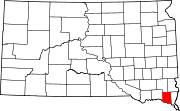
Bloomingdale is an unincorporated community in Clay County, South Dakota, United States.[1] It is located at an elevation of 1,227 feet (374 m).
42°55′28″N 96°57′23″W / 42.92444°N 96.95639°W / 42.92444; -96.95639
References
- ^ "Bloomingdale". Geographic Names Information System. United States Geological Survey, United States Department of the Interior. Retrieved November 24, 2014.
- v
- t
- e
Municipalities and communities of Clay County, South Dakota, United States
County seat: Vermillion
- Irene‡
- Vermillion
- Wakonda
- Burbank
- Meckling
communities
- Bloomingdale
- Hub City
- Westreville
‡This populated place also has portions in an adjacent county or counties
- South Dakota portal
- United States portal
 | This South Dakota state location article is a stub. You can help Wikipedia by expanding it. |
- v
- t
- e


