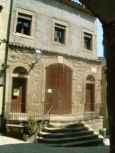
Artesa de Segre
Municipality in Catalonia, Spain
41°53′50″N 1°02′56″E / 41.89722°N 1.04889°E / 41.89722; 1.04889 Spain
Spain Catalonia
 (2018)[3]
Artesa de Segre (Catalan pronunciation: [aɾˈteza ðe ˈseɣɾe]) is a municipality in the comarca of the Noguera in Catalonia, Spain. It is situated in the valley of the Segre river, between Ponts and Balaguer. The municipal territory extends as far as the confluence of the Segre with the Boix. The Urgell canal runs through the municipality to the south of the Segre. The municipality is served by the C-1313 road between Balaguer and Ponts, and is linked to Agramunt by the L-302 road.
Demography
| 1900 | 1930 | 1950 | 1970 | 1986 | 2007 |
|---|---|---|---|---|---|
| 4712 | 4901 | 4600 | 3541 | 3250 | 3737 |

Subdivisions
The municipality of Artesa de Segre include nineteen outlying villages: populations are given as of 2005.
- Alentorn (143)
- Anya (32)
- Baldomar (127)
- La Clua (19)
- Colldelrat (33)
- Collfred (29)
- Colònia la Fàbrica
- Comiols (7)
- Folquer (4)
- Montargull (57)
- Montmagastre (22)
- El Pont d'Alentorn (31)
- Sant Marc del Batlliu (20)
- Seró (93)
- Tudela de Segre (108)
- La Vall d'Ariet
- Vall-Llebrera(35)
- Vall-Llebrerola
- La Vedrenya (15)
- Vernet (42)
- Vilves (58)
References
- ^ "Ajuntament d'Artesa de Segre". Generalitat of Catalonia. Retrieved 2015-11-13.
- ^ "El municipi en xifres: Artesa de Segre". Statistical Institute of Catalonia. Retrieved 2015-11-23.
- ^ Municipal Register of Spain 2018. National Statistics Institute.
- Panareda Clopés, Josep Maria; Rios Calvet, Jaume; Rabella Vives, Josep Maria (1989). Guia de Catalunya, Barcelona: Caixa de Catalunya. ISBN 84-87135-01-3 (Spanish). ISBN 84-87135-02-1 (Catalan).
External links
- Official website (in Catalan)
- Government data pages (in Catalan)
- v
- t
- e
Municipalities of Noguera
- Àger
- Albesa
- Algerri
- Alòs de Balaguer
- Artesa de Segre
- Les Avellanes i Santa Linya
- Balaguer
- La Baronia de Rialb
- Bellcaire d'Urgell
- Bellmunt d'Urgell
- Cabanabona
- Camarasa
- Castelló de Farfanya
- Cubells
- Foradada
- Ivars de Noguera
- Menàrguens
- Montgai
- Oliola
- Os de Balaguer
- Penelles
- Ponts
- Preixens
- La Sentiu de Sió
- Tiurana
- Torrelameu
- Térmens
- Vallfogona de Balaguer
- Vilanova de Meià
- Vilanova de l'Aguda

 | This Province of Lleida location article is a stub. You can help Wikipedia by expanding it. |
- v
- t
- e


